
One of the key ingredients for a ‘perfect’ walk, according to a recent public poll commissioned by Ordnance Survey, is to follow a circular route, yet they’re not always readily available.
Cue a brand new selection of circular routes across the Wales Coast Path and National Trails in Wales developed by experienced travel writer, Paddy Dillon, in partnership with local trail officers.
A circular walk, or a route that starts and ends in the same location, as opposed to walking a linear route from A to B, is a great way to experience the Welsh coastline and countryside without having to double back on yourself or use public transport to return.
33 new circular routes for the Wales Coast Path, and 12 across Offa’s Dyke and Glyndwr’s Way, have been curated using existing public rights of way, paths and roads in selected areas of Wales.
Highlighted routes along the Wales Coast Path include:
Oystermouth and Mumbles Head circular, Swansea
5 mile circular
This walking route around Mumbles Head takes in everything that that this headland has to offer, from spectacular sea views, Mumbles Head Lighthouse and Oystermouth Castle. The route follows the cliff tops of the Wales Coast Path, finishing off with relaxed promenade walk to return to Mumbles. If the tide is out, the walk can be extended from Mumbles Pier along a rugged beach to visit Mumbles Head, where a little island is crowned with a lighthouse.
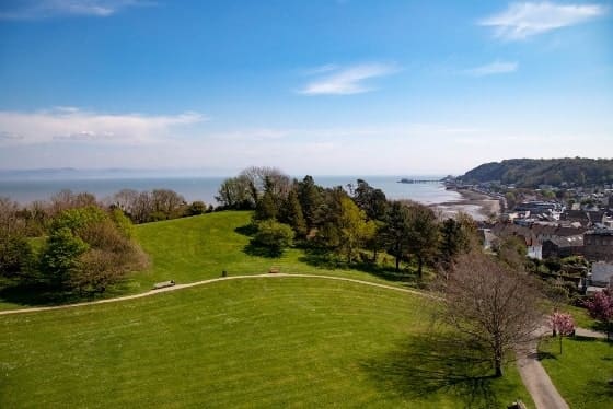
Llansteffan circular, Carmarthenshire
5 mile circular
This circular walk combines woodland with estuary views, and a visit to Llansteffan castle, spectacularly sited on a craggy hill at the mouth of the river Tywi, offering panoramic views over the estuary mouth to the Gwendraeth Estuary, Pembrey Forest, Cefn Sidan beach and across the Gower and Worm’s Head. The Wales Coast Path can then be followed from Llansteffan to Scott’s Bay and Wharley Point. To break up the walk, a trip into quaint Llansteffan village is also worthwhile.
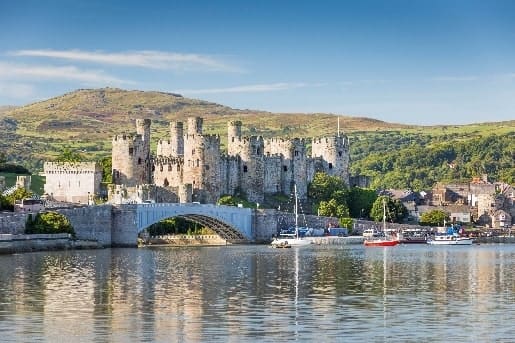
Conwy and Dwygyfylchi, Conwy
9 mile circular
Enjoy the World Heritage site of Conwy Castle, a magnificent medieval fortress still towering over the town after 700 years. In the distance rise the craggy mountains of Eryri and spread out below you are the harbour and narrow streets of Conwy – still protected by an unbroken 1,400-yard ring of town walls. The circular route will allow you to explore the castle and the wider area of Conwy, offering scenic mountain and sea views. The route heads inland behind Conwy Mountain to the Sychnant Pass and Dwygyfylchi, before linking up with the Wales Coast Path around the Penmaenbach headland to return to Conwy.
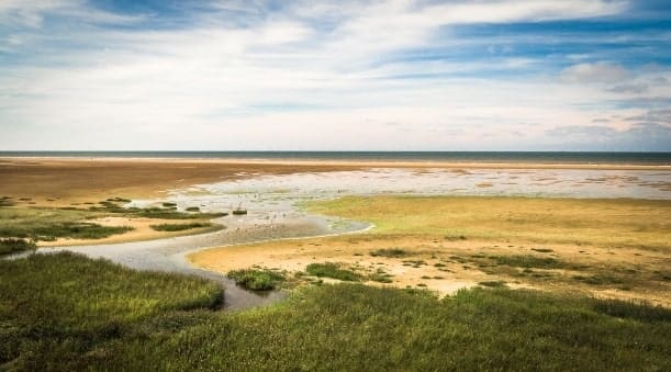
Porthcawl and Merthyr Mawr, Bridgend
6.5 mile circular
Set on the South Wales coast, Merthyr Mawr Warren National Nature Reserve is home to the highest dune in Wales, known as the Big Dipper. The dune system is like no other in Wales, partly due to the huge area it covers as it extends to 840 acres – the size of 340 international rugby pitches. Merthyr Mawr is a haven for wildlife, with sand that has settled on top of the ancient limestone cliffs creating a special habitat for insects, fungi and plants. There are also grasslands, saltmarsh, beach and woods within the reserve. The walk goes inland from Newton to Candleston Castle, allowing you to explore the vast dunes of Merthyr Mawr, before the Wales Coast Path is joined and followed to the mouth of the Ogmore River and back towards Porthcawl.
Prestatyn and Gronant, Denbighshire
7.5 mile circular
A great circular walking route taking in both the Wales Coast Path and Offa’s Dyke Path to reach the little-known village of Gwaenysgor, which has existed for over 6,000 years and is teaming with ancient burial sites and evidence of Stone Age, Bronze Age and Iron Age settlements from centuries ago. From Gwaenysgor the route follows an old byway across the hills and explores Coed Bell and the village of Gronant. Eventually the walk will take you to the low-lying coast to follow the Wales Coast Path through vegetated sand dunes to return to Prestatyn.
Head to the circular walks page on our website to discover all 33 of the new circular routes: https://www.walescoastpath.gov.uk/plan-your-visit/itineraries/circular-walks/?lang=en
Highlighted routes along both Offa’s Dyke Path and Glyndwr’s Way include:
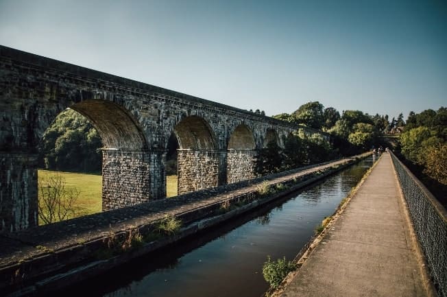
Chirk Castle, Offa’s Dyke Path, Wrexham
6.5 mile circular
A spectacular walk around the estate surrounding Chirk Castle, with an option to visit the castle from a stretch of the Offa’s Dyke Path. The end of the route will reward you with remarkable views of both Chirk viaduct and aqueduct – first open in 1848, the viaduct has ten impressive arches, each spanning 14m wide, and rising 30m above the river.
Chepstow Castle and Tintern Abbey, Offa’s Dyke Path, Monmouthshire
13 mile circular
Enjoy outstanding views and interesting history on this longer circular walk, which links the Wye Valley from Chepstow to Tintern. You’ll get to explore the hilltop fortress of Chepstow Castle, 900-years old but beautifully preserved as it stretches out along a limestone cliff above the River Wye; the old Chepstow Town Bridge; the 1km long Tidenham Tunnel; and the landmark of Tintern Abbey, still standing in roofless splendour on the banks of the River Wye nearly 500 years since the tragic dissolution of the monasteries.
Knighton, Offa’s Dyke and Glyndŵr’s Way, on the border of Shropshire and Powys
7 mile circular
Knighton marks the starting point of the 135-mile National Trail of Glyndŵr’s Way, named after Owain Glyndŵr, the Prince of Wales and Medieval Welsh nationalist leader who organised a rebellion against the English king. Leaving the historic market town of Knighton to first trace the famous earthwork of Offa’s Dyke over the Shropshire Hills, this route crosses the verdant valley of the River Teme and follows the Heart of Wales Line Trail from Knucklas, climbing steeply back into the hills, before linking back on Glyndŵr’s Way through woodland and back to Knighton.
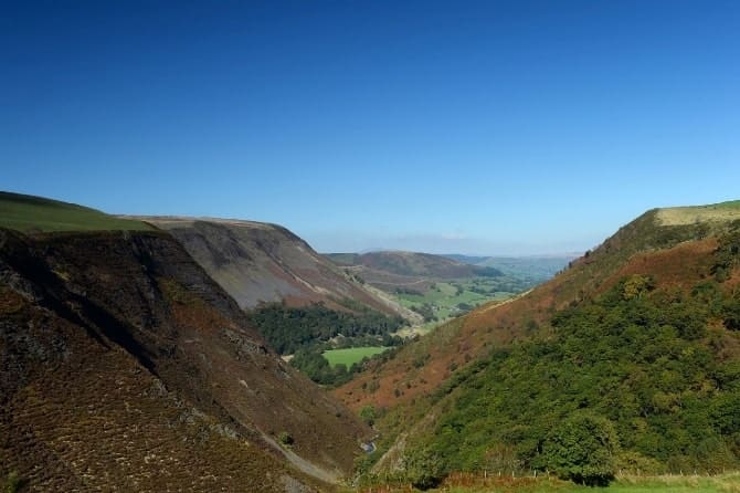
Dylife, Glyndŵr’s Way, Powys
11 mile circular
Dylife is a former mining settlement in Powys, located at the head of Afon Twymyn in the Cambrian Mountains, one mile west of the road between Llanidloes and Llanbrynmair. This longer circular walk takes in rolling hills, a Roman fortlet, old mining sites and the lonely moorland lake of Glaslyn. Along Glyndŵr’s Way, you’ll also pass remote hill farms and the tiny village of Aberhosan.
Head to the Offa’s Dyke Path and Glyndŵr’s Way pages on our website to discover all 13 of the new routes.
A selection of the circular walks are also available on the Ordnance Survey (OS) website. You will need to create an OS account, for free, to see these itineraries. Once done, you’ll be able to see the routes on an interactive map, a route profile and be able to export a GPX file to your own GPS device for each itinerary.
The itineraries also provide details of public transport, places of interest and hospitality. You can plan your journey using Traveline Cymru, the public transport information service in Wales.