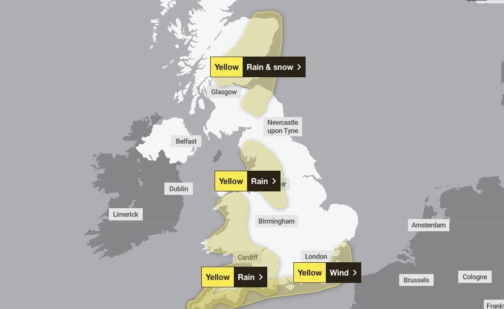
Outbreaks of heavy rain will move northeastwards across England and Wales during Wednesday.
Across the warning area 20-30 mm of rain is expected to accumulate quite widely. Across south facing slopes of Dartmoor and the Dorset Downs, the western Pennines and parts of the Lake District, 40-60 mm is likely during this period.
The greatest totals will probably be across the high ground of south and west Wales, where 70-90 mm of rain could develop.
Strong winds will likely exacerbate any impacts from the rain. Snow is also likely for a time across the higher Pennines, although this will turn to rain later.
What to expect
- Flooding of a few homes and businesses is likely
- Bus and train services probably affected with journey times taking longer
- Spray and flooding on roads probably making journey times longer
- Some interruption to power supplies and other services likely
What should I do?
Check if your property could be at risk of flooding. If so, consider preparing a flood plan and an emergency flood kit.
Give yourself the best chance of avoiding delays by checking road conditions if driving, or bus and train timetables, amending your travel plans if necessary.
People cope better with power cuts when they have prepared for them in advance. It’s easy to do; consider gathering torches and batteries, a mobile phone power pack and other essential items.
Be prepared for weather warnings to change quickly: when a weather warning is issued, the Met Office recommends staying up to date with the weather forecast in your area.
Regions and local authorities affected in Wales
- Blaenau Gwent
- Bridgend
- Caerphilly
- Cardiff
- Carmarthenshire
- Ceredigion
- Conwy
- Denbighshire
- Gwynedd
- Merthyr Tydfil
- Monmouthshire
- Neath Port Talbot
- Newport
- Pembrokeshire
- Powys
- Rhondda Cynon Taf
- Swansea
- Torfaen
- Vale of Glamorgan
- Wrexham


Leave a Reply
View Comments