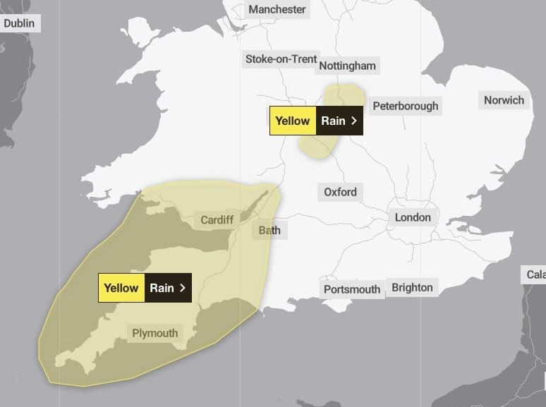
Further rain, on already saturated ground, is expected to move north and east to affect parts of southwest England and south Wales on Thursday morning and will become persistent and heavy at times.
15 to 20 mm of rain is expected to fall widely with 30 to 40 mm likely over higher ground. The rain will start to die out from the west after dark.
What to expect
- Bus and train services probably affected with journey times taking longer
- Spray and flooding on roads probably making journey times longer
What should I do?
Give yourself the best chance of avoiding delays by checking road conditions if driving, or bus and train timetables, amending your travel plans if necessary. Be prepared for weather warnings to change quickly: when a weather warning is issued, the Met Office recommends staying up to date with the weather forecast in your area.
Local authorities affected in Wales
- Blaenau Gwent
- Bridgend
- Caerphilly
- Cardiff
- Carmarthenshire
- Merthyr Tydfil
- Monmouthshire
- Neath Port Talbot
- Newport
- Powys
- Rhondda Cynon Taf
- Swansea
- Torfaen
- Vale of Glamorgan


Leave a Reply
View Comments