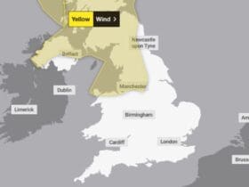
Another spell of wet and windy weather is expected on Tuesday when rain will be heavy at times and, given recent wet weather, likely lead to impacts in a few places.
- Between 05:00 Tue 18 Dec and 21:00 Tue 18 Dec
Over most of Wales, Devon and Cornwall the worst of the weather will have cleared by mid-afternoon whilst further east the worst conditions are likely to be during the afternoon and early evening.


This wet weather, meanwhile, will be accompanied by windy conditions with gusts in exposed coastal locations around 50-65 mph which means that some coastal routes, sea fronts and coastal communities may be affected by spray and/or large waves. Inland, gusts will be lower and mainly peak at 40-50 mph.
What to expect
- Flooding of a few homes and businesses is likely.
- Bus and train services probably affected with journey times taking longer.
- Spray and flooding on roads probably making journey times longer.
Areas in Wales likely to be effected
- Blaenau Gwent
- Bridgend
- Caerphilly
- Cardiff
- Carmarthenshire
- Ceredigion
- Merthyr Tydfil
- Monmouthshire
- Neath Port Talbot
- Newport
- Pembrokeshire
- Powys
- Rhondda Cynon Taf
- Swansea
- Torfaen
- Vale of Glamorgan


Leave a Reply
View Comments